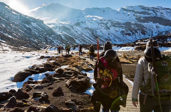
The Tongariro Alpine Crossing is frequently cited as the greatest day hike in New Zealand. After walking the near 20km route through lava rock-strewn fields, up and over sheer ice-covered mountainsides, and along narrow foot paths around an active volcano, I’m inclined to agree.
The crossing is a one-day offshoot of the longer multi-day Tongariro Northern Circuit, one of the Great Walks of New Zealand, and features many of the circuit’s more spectacular sites including the Emerald Lake and Mount Ngauruhoe (or Mt. Doom for the Lord of the Rings fans).
Both treks reside within the Tongariro National Park which is New Zealand’s first national park and the fourth national park to be established in the world. It also retains dual World Heritage Site status for both cultural and natural significance.
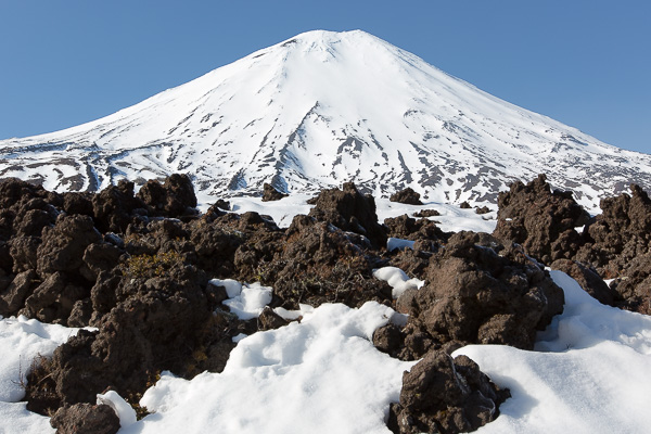
Lava rocks strewn about throughout the hike provided constant reminders that we were in an active volcano area.
Given we have no experience with mountaineering or alpine excursions (growing up in the mountain-less midwest does have certain drawbacks), we decided to attempt the circuit walk with a guide.
We were picked up by our curmudgeonly driver, Dan, at 6:00 a.m. in Taupo. While the greeting we received upon entering the van lacked warmth, Dan’s selection of tunes for the hour-and-a-half ride more than made up for it. It’s nice to see the 80’s alive and well in some parts of the world.
Dan dropped us off at “basecamp” where we were outfitted with gear including helmets, ice axes, crampons, gaitors, and anything else we might need (in my case, child-sized sunglasses as my head apparently stopped growing at around age six). Our group (about 24 people strong with 4 guides – eventually breaking us into two groups of 12) was then transported to the beginning of the trek, about 30 minutes away.
The walk starts just outside of the Mangatepopo Carpark along well-marked paths and boardwalks and through fields covered with grasses, snow, and lava rocks. Mount Tongariro and Mount Ngauruhoe rise up in front and around you as you walk; their peaks covered in snow and ice, cartoonish in their perfection.
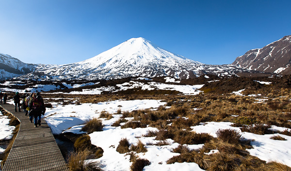
After about an hour, it was time to start the first of our two climbs with the subtly named “Devil’s Staircase” featuring a rise in elevation of about 200 meters gliding upwards at a near 45-degree angle. As the climb progresses, the change in scenery is drastic as you leave behind low-level shrubs and grasses and ascend to nothing but snow, ice, and rock.

Tongariro Alpine Crossing Elevation Map from here
We reached the top of the staircase and took in the view while basking in the joy of our first alpine experience. We were fortunate enough to have a really clear day and could therefore see the distant peak of Mount Taranaki all the way on the west coast of the island. We snapped photos, joked around with the group, and mocked the men that named the staircase given how easily it was conquered. The mountain was unimpressed and soon took its revenge.
The group was broken back up into smaller parties to strap on crampons and taught how to use them. This consisted of walking around like a duck for about five minutes while being told to avoid “tripping ourselves” before starting our second climb.
As far as I know, this second ascent does not have a name. I do not think that is because it is unremarkable, but instead because, after climbing it, I can’t see how a person would have any breath left to waste naming it. The climb gains a further 300 meters at an even steeper angle and without the cut-in platforms that graced the Devil’s Staircase. While it wasn’t pretty, we made it to the top with just enough energy to flop down and take in the view of the Red Crater in the foreground and the surrounding park land from 1,886 meters up.
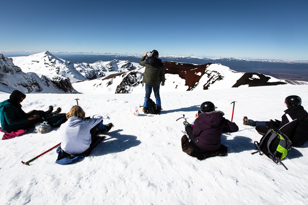
The top of the Red Crater and nearly the top of Mt. Tongariro.
After a quick 15 minutes for lunch and to catch our breath, we began our descent. If going up took poise and fortitude, going down only required a whimsical attitude and a broad backside (the Laws dominated this event). The group marched one-by-one up to the edge of a long, snow-covered decline, put our backpacks on our fronts, and slid down feet-first reaching breakneck speeds of up to 15km-an-hour. There is no better way to leave wariness behind!
When our glissading adventure came to an end, we crossed a wonderfully flat snow-covered expanse, eating up a few more kilometers in the process. At its end, the guides needed to make a decision about which route to take – a decision that split our opinion of the crossing.
Given recent thaws in the valley and the Department of Conservation’s clear message to avoid creating new trails, our guides decided we should continue on at elevation. To rejoin the trail, we needed to walk along the side of Mount Tongariro for nearly an hour-and-a-half using a narrow, ad hoc footpath instead of following the true path and descending to the valley below. I found the experience exhilarating as the snow was think, heavy, and able to bear the weight of the group using it. Select members of the tour disagreed (again, see Sarah’s article).
After winding our way along the path, we stopped for a quick rest at a now-retired backcountry bunk site that sat almost exactly on the dividing line between the alpine ridge and the lush forest below.
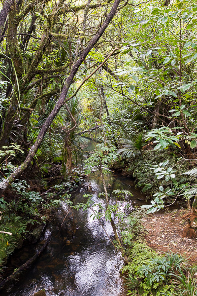
The scenery at the end of the hike could not be more different from that of the beginning or middle.
The final portion of the walk, a meagre 6.5km, brought us down into a dense forest full of unique New Zealand fauna. The change in scenery couldn’t have been more drastic and the greens and browns of a forest were a welcome sight after staring at the white and gray of snow and rock all day. We followed a well-marked pathway full of bridges and stairs which made the walking a bit easier.
Upon completing the trek, we were greeted by those who finished ahead of us while our borrowed gear was returned in exchange for a ice cold Tui beer and a well-deserved chair. Soon enough, we said our farewells to the group and our guides, welcomed the icy stare of Dan in his van, and cruised back to Taupo exhausted and elated.
